Презентация на тему: "Презентация по английскому языку посвященная дню Республики Башкортостан"
- Категория: Презентации / Другие презентации
- Просмотров: 82
Презентация "Презентация по английскому языку посвященная дню Республики Башкортостан" онлайн бесплатно или скачать на сайте электронных школьных учебников/презентаций school-textbook.com

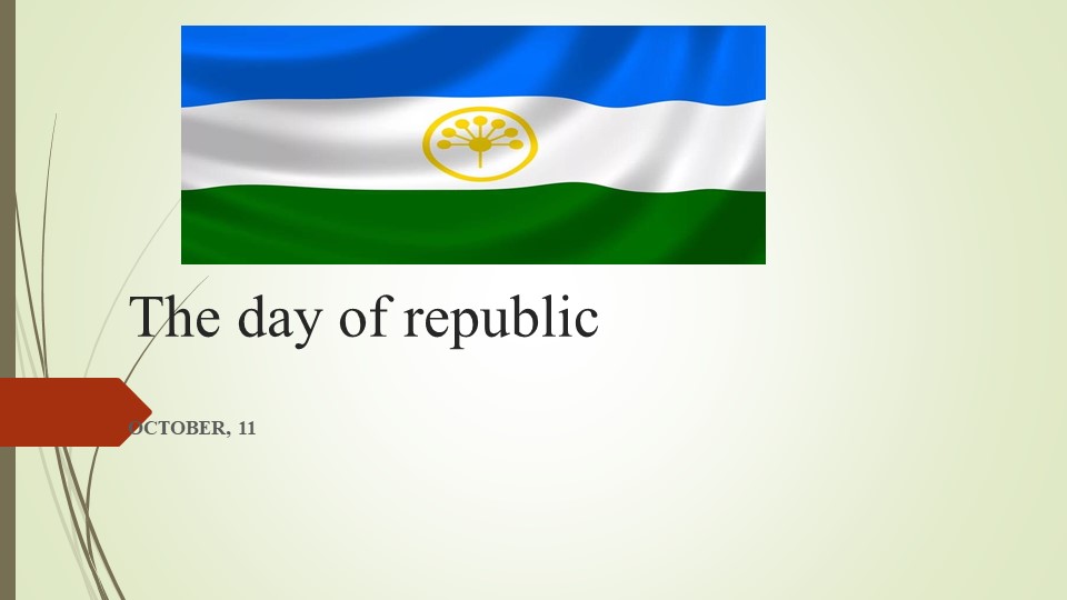
The day of republic
OCTOBER, 11

Guess meanings
Blue ?
White ?
Green ?
Kurai ?
Freedom (свобода)
Intergrety
Peacefullness(мир)
friendship

Colours and their meanings
The blue represents the integrity, and the excellence of the thoughts of the Bashkir people,
and the white stands for their peacefulness, and their willingness to cooperate,
and the green for freedom, and eternal life.
Kurai flower- symbol of friendship

Toungtwisters
A happy hippo hopped and hiccupped.
Specific Pacific.
Green glass globes glow greenly.
The big bug bit the little beetle.
Three free throws.
Red lorry, yellow lorry.
Selfish shellfish
Daddy Draws Doors.

Answer the questions
1. Who is the president of Bashkortostan?
A. Radick Yulyakshin
B. Radiy Habirov
C. Vladimir Putin
2. What is the national sport?
A. Basketball
B. Soccer
C. Kuresh

Answer the questions
3. What is the national drink?
A. kumis
B. milk
C. coke
4. What is the national food?
A. rice
B. chicken
C. bishbarmak

Answer the questions
6. What is the national musical instrument?
A. violin
B. kurai
C. piano
7. The capital of Bashkortostan is….
A. Uchaly
B. Moscow
C. Ufa

Have a rest…dance together

All about Bashkortostan

Fill in the gaps
Belaya, mountains, trees, Bashkiriya, forested
Deciduous-лиственные
Bashkortostan, also called …….., republic in Russia, extending from the western slopes of the southern Ural …….. in the east to the rolling hills of the Bugulma-Belebey Upland in the west.
From Mount Yamantau, the highest peak in the southern Urals, elevation generally decreases southward and westward, with the heavily ……. mountains giving way to open steppe interspersed with islands of mainly deciduous ….. and to the floodplains of the …… River.

Check your answers!
Bashkortostan, also called Bashkiriya, republic in Russia, extending from the western slopes of the southern Ural Mountains in the east to the rolling hills of the Bugulma-Belebey Upland in the west.
From Mount Yamantau, the highest peak in the southern Urals, elevation generally decreases southward and westward, with the heavily forested mountains giving way to open steppe interspersed with islands of mainly deciduous trees and to the floodplains of the Belaya River.

Thank you for attention!